Accession#:
2010A-103
Title:
Stinson Beach 1961
Catalog Date:
11/02/2010
Collection:
SBHS Archival Collection/Map Collection
Creator:
RM
Dates of Creation:
1961
Scope & Content:
A print of illustrated street map of Stinson Beach. The original was probably done in ink and shows street of Stinson Beach . It does not include Seadrift where hardly any houses were then. The map also shows then existed Seadrift Causeway. The library is located 3450 or 54 of Shoreline Highway where the Oceanic Realter office is located now. The map is illustrated with fish and sea birds for water, volley ball net for the State Park (beach), castles for the community center, and rooster for the traditional north arrow. It is signed RM 1961 at lower left.
Search Terms:
1961
Maps
Stinson Beach Town
Stinson Beach Library
Maps
Stinson Beach Town
Stinson Beach Library
Click to Enlarge
 Map of Stinson Beach 1961
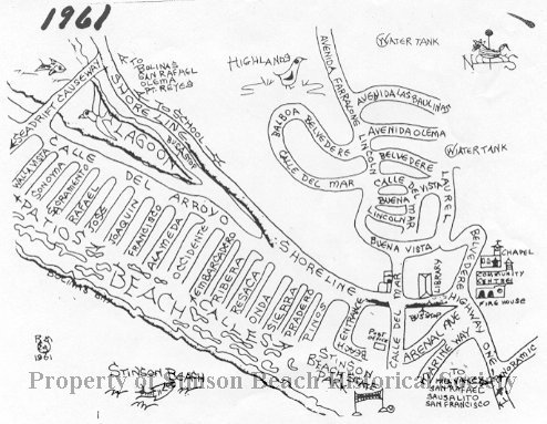 Map of Stinson Beach 1961